Sunday, March 7, 2010

The Atlas, Shrugged Off


The Atlas, used at last...


Posted by Rich -
I recently ferreted out an old Atlas my Father brought home from work one day in the late 1960’s. It’s rather tattered and creased, but I think it is remarkable that it lasted as long as it has. I retrieved it from a box of old magazines in the attic to take a look at how the roads had changed since it was given to my Father as some sort of safety award over 40 years ago. My Dad worked in a steel mill that made specialized alloys, and at one time his job on the factory rolling mill consisted of using hand held tongs to catch bars of red hot steel as they flew out of furnace rollers and across a polished floor. With a crew of three other men, they would grab the hot bar as it slid, and together throw it back across the floor between more rollers (click here: http://en.wikipedia.org/wiki/Rolling_mill for a more accurate description of this metallurgical process). Looking at this soft cover book now, I honestly think he should have received more than this as a reward for staying injury free in a work place that daily featured red hot metal bars sailing across the floor. At least, a hard-cover version would’ve seemed more adequate.

It is interesting, however, to look in this 40+ year old book with it’s safety and travel tips and contrast it with the landscape and technology of 2010. I suppose we all thought we would be traveling by nuclear powered vehicles hovering inches above immaculate high speed roadways by now, but when you consider we can use a single hand held device to communicate by voice, email, text, video, and access the Global Positioning System and National Weather Service all within seconds, the future turned out to be pretty impressive after all. I noticed looking at the map section of the Mid-Atlantic States that I-95 was still in small unconnected sections, with the same going for Route I-81 that now stretches from Virginia to the Canadian border above NY State. The highways and roads that interchanged around metropolitan New York and Philadelphia looked very confusing and absolutely intimidating; I’m glad I wasn’t a young driver trying to navigate my way through these areas in 1965. As much as I may disparage the four-lane expressways across the country as impersonal and uninteresting, when it comes to getting to where I want to go in the shortest amount of time possible, I am glad to take advantage of them. And the map of New Jersey included in this atlas, small as it is, does indeed include the town of Mahwah. I believe Ford still had a large automobile assembly plant there making Thunderbirds and F-100’s at the time. I-287 that now runs by the former site of the plant was just a dotted line on the map with the word “Proposed” running along side it in very small type.

I recall looking for hours at the maps in this booklet and committing to memory the safety tips included within. I imagined my family packing up our Fairlane 500 station wagon for an extended road trip, and just as we were about to leave, ceremoniously placing this Atlas in the vehicle. It would of course need to be within easy reach of the driver (in the glove compartment!) in case it was needed for reference as we navigated our way across the Rocky Mountains or the Florida Everglades. It was especially important to have it on hand in the case of a flat tire or any other roadside emergency for advice on exactly how to handle that situation.

This Atlas remained unused however, as almost all our family trips were up NY Routes #12 and 28 to the Adirondacks, less than hour away from our house. My father knew these roads so well he could have probably driven them with his eyes closed. Given that the ride to Old Forge seemed almost interminable (actually 55 minutes at most) and I always sat in the rear facing jump seat of the Fairlane wagon, a trip to the Rockies and beyond would’ve been too much to bear. We rarely went much further than Eagle Bay on a single ride, and the Atlas went unused. Just as well, there were no words of advice in it on how to handle the boredom of a long car trip in the rear facing seat of a 9 passenger station wagon.

I think I really hung on to the booklet because of the illustrations, executed with a tidy early 1960’s stylization. The Atlas bears a copyright mark from 1967, “before things went all hippie”, as an older designer I worked with in the art department at General Electric once remarked, regarding the visual culture of the 1960's second half. I was only 7 years old at the time this book was printed, so when things “went all hippie”, I actually thought it was pretty cool. For stylistic visual changes, I personally use a different timeline: the first one I noticed occurred in 1973 or so, when it seemed everything “went all Bicentennial”, with colonial red, white and blue and decals of Minutemen and eagles appearing everywhere. This Atlas may well have survived so long because it spent a good part of that decade ensconced in a metal 20 gallon paint can that my mother had fashioned into a colonial-looking drum around the same time. As crafts projects go, it was pretty ambitious, with a circular plywood top cut to the circumference of can opening and upholstered with fabric decorated with eagles and Betsy Ross-style U.S. Flags. This project required a lot of work to complete, and I guess it was intended as a magazine holder, because it sturdily performed that function in our family room well into the early 1980’s. Somewhere along the way, I transferred the Atlas from the can/drum/magazine holder to boxes of old magazines I collected as an illustration student. In the pre-internet days, we were advised by our college instructors to begin assembling a “morgue”, or clip files, of pictures of different subjects to keep on hand as photo reference for illustrations. For years I dragged around boxes of magazines and pictures in folders and small metal file cabinets, never knowing what I may need next. I still have a file cabinet full of “swipes”, as some older illustrators called them, in my attic. Even though the practice of collecting all this material has been rendered obsolete by Google and other internet search engines, just like the faux colonial metal drum/magazine holder/craft project, it was a heck of a lot of work assembling all those clips from People and National Geographic magazines and I am not about to abandon all that effort too quickly. Unlike the drum/magazine holder, though, I doubt I will be able to sell this collection of material at a yard sale; however, if my internet goes down, and I have a rush freelance illustration assignment to draw a picture of Andrea McArdle performing her role of Annie in 1977, I’m prepared.


an illustration from the Atlas...
hmmm.. that car looks like a Fairlane...

Monday, March 1, 2010

Nearly Night in Titusville


Posted by Rich-A relatively calm day weather-wise, and I found myself with a few minutes to spend working on this show. Whenever I begin the process of preparing for an exhibition, I always worry that I won’t have enough images to create paintings from– I’ve always relied on photographic reference to create my work – but I usually end up with more inspiration than I can use, and a few sketches that never quite make it to finished paintings. The feeling that I won’t have enough works completed by September 1st was eating at me, and with the day looking somewhat sunny, I decided to head over to New Jersey and see what I could get for reference. Hoping for some opportunities to get pictures with nice long shadows in the winter sun, I drove over the Washington Crossing Bridge to Route 29 and turned north towards Lambertville. Fortunately, this narrow bridge between Pennsylvania and New Jersey is only 10 minutes away from my house, and with the sun just a half hour or so from setting I decided to take the first left turn after Washington Crossing State Park into Titusville. Both PA and NJ have Washington Crossing State Parks on their sides of the Delaware River respectively, one park to commemorate where George and company launched their boats and the other to mark where they landed shortly afterwards. Titusville is located directly north of the park on Rt 29.
I’m not entirely certain how big Titusville is, but this section of the town occupies a very narrow strip of land between the Delaware River and the old D&R Canal, perhaps 200 yards wide at it’s narrowest point. The street that runs parallel between the river and the canal is occupied by classic old frame houses that appear to be meticulously maintained and very comfortable at the same time. It’s as if the entire strip along the river was modeled after a Norman Rockwell guide on how to make your house appeal to your grandchildren. Couples strolled along the sidewalk that ran along the Delaware River on this somewhat warmish winter afternoon, passing by the Old Baptist church from the 1800s and the Titusville Academy, a classic brick and stone school building that appeared to have been built shortly after the turn of the last century and was still enjoying use by young children. As I walked through Titusville and took some photos, I could see homeowners had switched on their porch lights in anticipation of sunset, and interior lighting inside was already giving these classic structures a warm glow from within. I caught a glimpse of a gentleman sitting in his glass enclosed sun porch reading his Sunday paper in the warm light of the setting sun. All very idyllic. Idyllic, except for the guy in the baseball hat walking around with a tri-pod taking pictures… After exchanging a few polite greetings with a strolling couple or two, I realized halfway through my snapping of pictures in this small, picturesque edge of New Jersey that a guy who parked a pick up truck with PA plates across from the Baptist Church and was taking pictures of the houses might not fit in with a Norman Rockwell guide at all; perhaps a chapter in the Crimestoppers textbook would be more applicable, and the porch lights were being flipped on just in case I turned out to be more Norman Bates instead of Norman Rockwell. After some quick consideration, I decided to fore go an attempt to get a picture of the man reading his paper on his sun porch, and thought I could perhaps get better shots of a seemingly unoccupied house straddling the street and the river further up the road. It also occurred to me it would be easier to use my artistic license and paint the warm glow of interior lights in these lovely houses than explain to the Town of Hopewell Police why I seemed to be casing the town and taking photos. At least, I think it is the Town of Hopewell Police that have jurisdiction there. I wasn’t about to hang around and find out.


Notice the light in window...Photoshopped in...

Wednesday, January 20, 2010

Posted By John - Many thanks to Rich for coming up with the idea for this project/exhibition, and for taking the initiative in launching this blog. I hope to share my thoughts about this project as it unfolds, so people can participate and react as it develops.

I’m trying to capture images of things that you would think you’d NEVER see in New Jersey, as well as things that you’d think you would ONLY see in New Jersey. I’m hoping that when seen together it will look both weird and familiar – and that’s exactly the way that I see New Jersey.

Every state is urban and rural , tangled and desolate, hot and cold, old and new. But in New Jersey it’s the people, not the place, that can be described that way.

Ultimately, this project is about the people of New Jersey. Whether they appear in the work or not, they are the ones who built the quirky and majestic monuments to the human spirit throughout the state. And they are the ones who preserved the remaining open spaces and wilderness.

So, follow us on the journey, and tell us where you’d like it to go. I know I’ll be taking photos of diners, the shore, and the Pine Barrens. There’s a large altar in the woods in Mt. Holly with the inscription “Holy, Holy, Holy”. There’s a big tooth sculpture along the roadside in Hamilton. And I’m just getting started…

Sunday, January 17, 2010

The Long Way to Lambertville

Posted By Rich-A sunny weekday during semester break afforded me a chance to take a few back roads through New Jersey on my way to pick up work from the Artists’ Gallery in Lambertville. Instead of heading up Rt 29 from Washington’s Crossing, I entered into New Jersey on I-95 using the Scudder’s Falls Bridge over the Delaware River (and although I am well acquainted with the Pennsylvania side of the river at that point, I have never seen a waterfall in the vicinity I consider large enough to name a bridge for. Maybe the name comes from the NJ side…?)
I took the North off ramp of the second exit on the interstate, and almost immediately I was obliged to take a detour, so it became a rather easy task to take a road less traveled. Well, one less traveled by me, anyways. Seems like all of the roads in this part of the country have heavy traffic.
The afternoon sun cast long shadows over nondescript office parks and even more nondescript housing developments that appeared like odd growths on the former farmland. Styles of the houses reflected boom times from different eras: post WWII Cape Codders , sprawling ‘50s ranches, split levels from the ‘60s and ‘70s, and odd “transitional” styles from the 80’s and later that we have come to know collectively as “McMansions”. Following the detour signs, I ended up in Pennington and stopped at a service station to buy a road map of NJ. After studying it briefly, however, I decided it wasn’t a very good one: for instance, it completely omitted Mahwah, a larger northern NJ town near the border of New York Sate and the home of inventor and guitar great Les Paul. Mahwah is also a landmark I use when racing up I-287 to the Tappanzee Bridge and over the Hudson to get my daughter at college in New England.
I drove north out of Pennington through intermittent collections of dwellings that ranged from modest farmhouses to the aforementioned McMansions, houses that seemed ridiculous by contrast with ostentatious displays of ornamentation and imitation stone work. Eventually I entered the delightful town of Hopewell, NJ. I had been to Hopewell once before with a good friend who grew up there in the 1950’s and early 60’s, and it appears that not much has changed since then. My friend gave me the cook’s tour of the place on that day and I was glad to return and have a chance to take a few pictures. I parked my truck and walked a bit, heading towards the Hopewell train station. It is a grand brick Victorian structure, well preserved both inside and out and situated nicely by itself on the edge of town. However, it appears one of the things that have changed in Hopewell since the 1950s is that trains no longer make regular stops there, although the track is still active; a CSX freight rolled through and the echoes of the noise on the frame houses sounded like a jet aircraft taking off at Newark International. I walked around town for a while and shot some reference pix, and on a quiet side street (pictured above) a barking dog came running quickly across a yard at me. I was a bit alarmed when it became evident the dog was not restricted to the yard by an electronic device attached to it’s collar, but the dog’s wagging tail and happy bounce up to me showed me I had no reason to be afraid.

Greeted by a happy dog on a quiet street in a small town on a sunny afternoon; felt kind of nice to be in Hopewell right then.

Friday, January 1, 2010

Posted by Rich
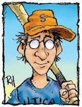
Rich is the one with the baseball hat on. John is the photographer, so of course his pic is the better one. John and I will both be posting images and messages about progress towards our exhibit at the Artists' Gallery in September, 2010.

Just this past week I had to deliver work up to the Society of Illustrators in Manhattan, NYC, and found myself yet again driving as quickly as possible through New Jersey. Seems like most of the time I travel through New Jersey I drive or ride the train as quickly as possible through it, whether going to the shore or to New York City. Other times I cling to the edges of the state, driving along the Delaware River or the Atlantic Ocean...I have always enjoyed John Steinbeck's book Travels With Charley, and even Steinbeck seemed to drive through New Jersey as quickly as possible. My paperback copy is 277 pages long, and Steinbeck devotes one short paragraph to his travel through the Garden State: "New Jersey was another turnpike. My body was in a nerveless, tireless vacuum. The increasing river of traffic for New York carried me along, and suddenly there was the welcoming maw of Holland Tunnel and the other end home." Granted, he was finishing up a drive around the country that took a few months and culminated with first hand experiences with the civil rights movement early 1960's, so who can blame him for not stopping and writing about the bridge over the Raritan River in Edison, NJ, with home at just the other end of the tunnel. Or, perhaps he did stop, and his editor axed that passage to devote more attention to his conversations about the "Cheerleaders" trying to keep New Orleans public schools from being integrated. However, I cannot claim that type of distraction, so for this particular exhibition John and I are undertaking we plan on driving the roads that are marked in blue on a road map of New Jersey that John has; for myself, diners have always been a favorite subject of mine, and New Jersey seems to have a fair number of interesting ones, so I am planning on making some of these trips to various diners that are listed on www.njdiners.com.

Not exactly a Steinbeckian journey, but I think I can get some pretty good reference for paintings. I suppose I could take my dog Maggie along, too.